
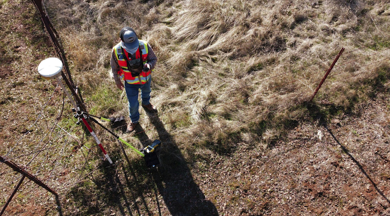
Accurate field positioning depends on more than a good GNSS receiver. The correction network behind the receiver also matters because station distance, signal quality, uptime, and regional availability affect how stable the final position is.
Strong RTK precision is easier to maintain when field teams use RTKdata as a provider with access to a large RTK network, including more than 20,000 base stations across 140+ countries.
Wide coverage, 24/7 monitoring, and easier integration help surveyors, drone teams, farmers, and asset crews receive dependable correction data during daily fieldwork.
Why Station Coverage Matters
Coverage affects how close a user is to a reference station and how consistently correction data reaches the receiver. Shorter distances support better correction quality, while wider access reduces interruptions when teams move between locations.
EUSPA reports that RTK provides near-instant high-accuracy positioning within 10-20 km of a base station, with accuracy up to 1 cm + 1 ppm. This is why nearby stations matter for crews that rely on stable field positioning.

Station Density
Station density counts because a single reference point may not serve every field, road, jobsite, or asset route equally well. When several stations are available in a region, equipment has a better chance of using a suitable correction source.
A correction system also needs a reliable data center to process, distribute, and manage station streams for many users at once. If the network backend is weak, even well-placed stations fail to support consistent work in the field.
Distance from the Receiver
The farther a rover is from a reference station, the more local atmospheric and signal differences affect results. According to USGS, real-time network reference stations are commonly spaced 10-50 miles apart. Dense coverage helps reduce long baseline problems and supports more predictable positioning.
Industries That Need Wide Coverage
Industries using precise positioning work across large areas, changing terrain, and different signal environments. More stations help these teams keep accuracy consistent instead of treating every site as a separate technical problem.
Surveying and Mapping
Surveyors need dependable corrections for topographic points, control checks, boundary support, and as-built data. Wide access helps crews move between sites without setting up a private base each time.
The Vermont Agency of Transportation shows this in practice: during RTK GNSS field testing, it used the Vermont CORS Network, with corrections from CORS stations accessed by cellular modem. The NGS case shows how state CORS coverage supports fieldwork across different sites without requiring a separate temporary base setup.
Construction and Infrastructure
Construction teams use precise positions for staking, grade checks, utility marking, road alignment, and machine guidance. Reliable network coverage matters because crews often work across road corridors, subdivision sites, and remote industrial lots in the same week, without time to set up a private base at every location.
Wider station access also supports machine control workflows where graders, dozers, and excavators rely on consistent corrections throughout a shift. A break in the correction stream can stop earthworks until accuracy is verified again, so stability translates directly into uptime.
Drone Operations
Drone teams need accurate position data for mapping, inspections, and repeated flight paths. As of December 2024, 427,598 remote pilot certifications had been issued, mainly supporting commercial and public-use small drone flights.
Access to more stations improves repeatability when flights happen at different parts of a site or across several customer locations.
What Better Coverage Improves
A larger station network improves field speed, repeatability, and confidence in collected data.
Field Productivity
Good coverage reduces time spent troubleshooting correction access. Crews begin work faster when nearby stations are available and the connection remains stable.
Field productivity improves through these gains:
- Less base station setup time
- Fewer interruptions during collection
- Faster movement between job locations.
Repeatable Positioning
Repeatability matters when crews return to the same site over weeks, months, or seasons. Agriculture, public works, utilities, and industrial teams need records that align with previous measurements. A consistent correction network helps compare changes over time.
Lower Operational Friction
More stations reduce the need for temporary local bases, extra setup checks, and last-minute changes. This helps teams that manage several crews or cover large territories. Lower friction also supports training. Newer users follow a standard process instead of making complex decisions about base placement on every job.
Practical Coverage Checks
Coverage should be reviewed before choosing a subscription. Teams should compare station locations, supported regions, receiver compatibility, mobile signal availability, correction formats, and support response. Terrain, buildings, trees, weather, and mobile network quality affect whether corrections perform well at a specific site.
Final Value of Better Coverage
Access to many stations makes RTK correction services more useful because teams work across more places with fewer setup problems. Better coverage supports survey work, construction, public assets, drones, and industrial operations that depend on repeatable location data.
RTKdata fits teams that need accurate, repeatable positioning in the field. Its large monitored RTK network, device support, and broad station access help reduce delays and support cleaner positioning data for different industries.
