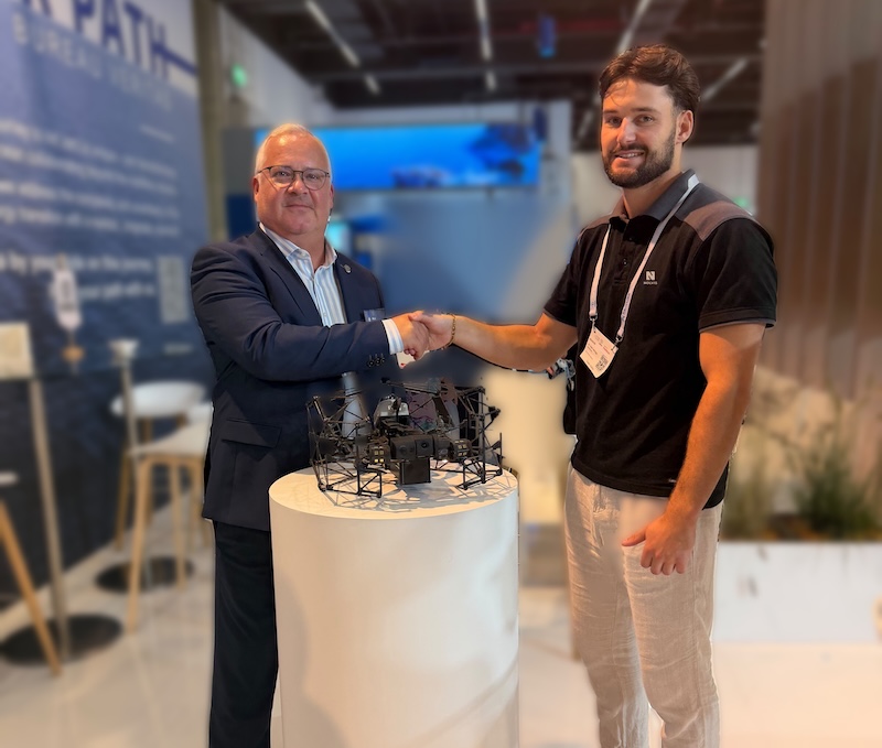
Bureau Veritas Marine & Offshore is using the Nolvis X1 industrial drone to carry out remote inspections of confined and hazardous spaces aboard ships and offshore installations, reducing the need for personnel to enter potentially dangerous environments.
Developed by Dallas-based Nolvis, the X1 is designed to operate inside ballast tanks, cargo holds, boilers and other enclosed spaces where satellite navigation is unavailable and conventional inspection methods can be difficult, expensive and potentially hazardous.
The drone is being used to support Bureau Veritas’ Remote Inspection Techniques (RIT) activities in several countries, including France, Türkiye, Greece and Denmark.
The collaboration was showcased at the SMM 2026 maritime exhibition, held in Hamburg, Germany, from September 1 to 4, where the X1 was displayed at the Bureau Veritas booth alongside demonstrations of confined-space inspection.
Reducing the need for confined-space entry
Inspecting the internal structures of large ships and offshore facilities has traditionally required personnel to enter enclosed spaces, often using scaffolding or rope-access equipment.
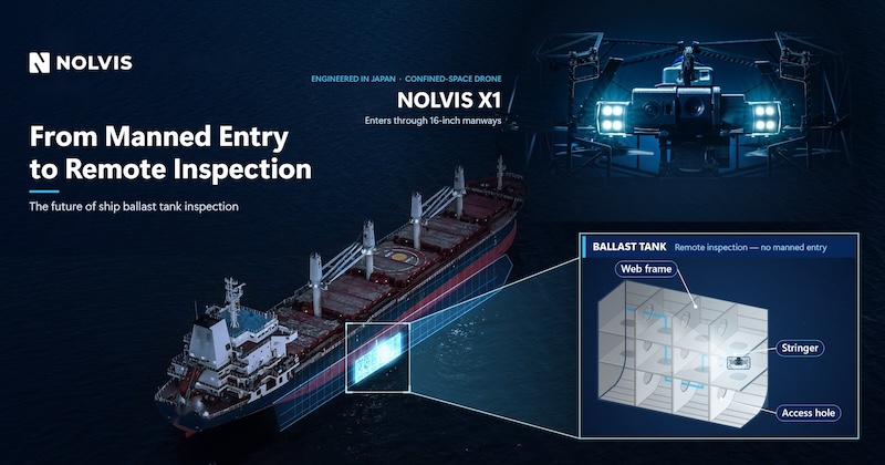
These environments can present significant safety risks, including oxygen deficiency, toxic gases, high humidity and elevated temperatures. Preparing them for human entry can also involve ventilation, safety permits and other time-consuming procedures.
Bureau Veritas has developed its RIT methodology to address some of these challenges by combining remote inspection technologies with the expertise of qualified marine surveyors.
Under this approach, drones collect visual and spatial information from difficult-to-access areas, while certified surveyors remain responsible for evaluating the findings and making inspection decisions.
According to the companies, the technology can reduce the need for confined-space entry, shorten inspection times and minimize disruption to vessel operations.
In a statement, Nolvis says: “The maritime industry is moving away from sending people into tanks and holds, and towards remote inspection. Together with Bureau Veritas, we are making that shift real on working vessels. The drone goes in, the people stay out, and the certified surveyor still makes the call. This is no longer a demonstration; it is how inspection is starting to be done.”
Designed for navigation without GPS
The Nolvis X1 has been developed specifically for indoor and confined-space inspections, where conventional GPS-based navigation cannot be used.
Measuring approximately 40 cm across, the aircraft can pass through access openings as small as 18 inches, allowing it to enter standard manholes and hatches found on ships and industrial equipment.
It uses an internally developed LiDAR system and forward-facing vision sensor to maintain stable flight in dark environments without access to Global Navigation Satellite System (GNSS) signals.
For inspection work, the drone carries a 4K camera with 180-degree tilt capability and a 10,000-lumen LED lighting system. This configuration allows operators to capture detailed images of structural surfaces, including overhead areas that may otherwise be difficult to examine.
Nolvis says the system can be operated by personnel without extensive drone-flying experience following a short training course.
In addition to recording video and photographs, the X1 generates a three-dimensional point cloud during each flight.
The resulting data can be exported in the industry-standard LAS format and managed through Nolvis X Cloud, a browser-based platform that allows inspection teams to review, annotate, report and share their findings.
By linking inspection imagery and spatial information to the geometry of an asset, the system is intended to support more structured inspection records and longer-term monitoring of vessel and offshore infrastructure.
Supporting digital inspection records
The use of drones for marine inspections forms part of a broader shift toward digital asset management, with operators seeking more consistent records of equipment condition and structural integrity.
For shipowners, inspection data collected over time can help identify deterioration, document maintenance requirements and support decisions about repairs.
Bureau Veritas says the combination of drone technology and qualified surveyors allows it to extend inspection capabilities while retaining human oversight of technical assessments.
In a statement, Bureau Veritas Marine & Offshore says: “The deployment of Nolvis X1 supports our commitment to safer, smarter and more efficient inspections. By combining advanced drone technology with the expertise of our surveyors through Remote Inspection Techniques, we can reduce confined-space entry while delivering high-quality inspection data that helps our clients manage asset integrity and operational performance.”
Further inspection capabilities under consideration
Nolvis and Bureau Veritas plan to continue exploring ways to expand the capabilities of remote inspection systems.
One potential development is the integration of ultrasonic thickness measurement technology, which would allow drones to collect information about material thickness alongside visual imagery and three-dimensional spatial data.
Such measurements are important in marine and offshore inspections because they can help identify corrosion and structural deterioration in tanks, hull structures and other critical components.
Combining these capabilities in a single inspection platform could further reduce the need for personnel to access hazardous spaces, although the companies have not announced a timetable for introducing ultrasonic measurement capabilities on the X1.
Nolvis, which is headquartered in Dallas and engineers its flagship drone in Japan, also targets applications in pressure vessels, underground infrastructure and other industrial environments where access is restricted.
