The British Antarctic Survey says autonomous vehicles are ‘transforming polar science’
A robot is cruising beneath Antarctic sea ice. Another is bolted to the face of a collapsing Greenland glacier. A third is silently counting penguins on a remote, windswept beach.
None of them has a human operator nearby.
Across the Arctic and Antarctic, autonomous robots are changing the way scientists explore some of the world’s most remote and inhospitable environments.
Operating underwater, on the ocean surface and in the air, they are collecting data over periods of weeks and months, often in places that are too dangerous, too expensive or simply impossible for people to reach.
The growing use of autonomous vehicles is allowing researchers to monitor glaciers, oceans, wildlife and climate processes on a scale that would have been difficult to imagine only a decade ago.
Dr Alex Brearley, an oceanographer at the British Antarctic Survey (BAS), is among the scientists taking advantage of the technology.
“It’s really cool to be able to whip out my phone here in Cambridge and send commands to a glider that’s doing stuff thousands of miles away in the Antarctic.”
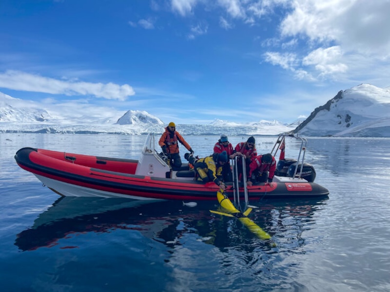
Brearley manages several autonomous underwater gliders operating in Ryder Bay near Rothera Research Station on the Antarctic Peninsula.
Rather than relying on engines or propellers, the torpedo-shaped vehicles change their buoyancy to glide slowly through the water, periodically surfacing to obtain a GPS position, transmit data and receive new instructions. Careful power management allows them to remain at sea for months.
The gliders monitor how glacier ice calving into the sea creates powerful waves that mix heat and nutrients through the water column while transporting carbon into deeper waters.
The phenomenon, known as “internal tsunamis”, was first detected from a research ship. Autonomous gliders now provide much longer and more detailed observations.
“The gliders come in later as the way to observe the same kinds of processes but in much higher resolution,” Brearley says. “It’s often about having the longevity of the missions that a ship can’t do without spending vast amounts of money.”
Robots reach places humans cannot
One reason autonomous systems have become so widely adopted is that they can work in environments that would present unacceptable risks to people.
A good example is BAS’s GIANT (Greenland Ice sheet to AtlaNtic Tipping points) project, which is investigating how warm ocean water melts Greenland’s glaciers.
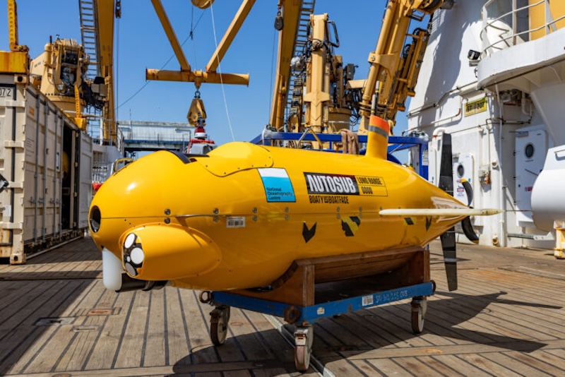
The project combines nine autonomous systems, including the yellow autonomous submarine known as Boaty McBoatface.
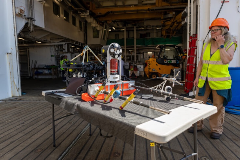
Among the most unusual is Meltstake, an automated scientific platform designed to attach itself directly to the face of a glacier.
Delivered by an autonomous boat and positioned by a remotely operated underwater vehicle, Meltstake screws itself into the glacier wall 100 to 200 metres below the waterline and gradually advances as the ice melts.
Equipped with cameras, hydrophones and acoustic instruments, it continuously measures the interaction between ocean water and glacier ice from a position no human scientist could safely occupy.
The system is helping researchers investigate why existing climate models appear to underestimate glacier melting.
Professor Erin Pettit of Oregon State University believes the glacier itself plays a more active role than previously understood.
“It’s packed with tiny, pressurised bubbles that hiss and burst as they are released into the water. When the bubbles pop out, they disturb the boundary layer of the fluid,” Pettit explains. “This creates a chaotic churn that generates more of that energy that then feeds back to melt the ice even faster.”
Watching wildlife from thousands of miles away
Autonomous aerial systems are also transforming wildlife monitoring.
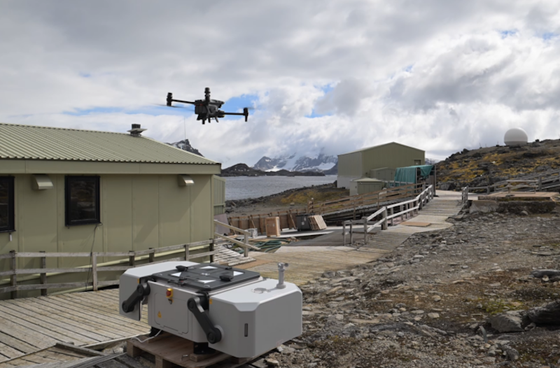
On Signy Island in the South Orkney Islands, BAS seabird biologist Dr Norman Ratcliffe has deployed a “drone in a box” that remains permanently stationed in Antarctica.
The drone lives inside a protective docking station where it recharges between missions before carrying out pre-programmed surveys of penguin colonies.
Scientists in Cambridge can schedule flights remotely throughout the year, allowing them to monitor breeding activity even when no researchers are present on the island.
“If we can pilot things safely from Cambridge, that allows us to do surveys almost any time of year, irrespective of the staffing we have on station,” Ratcliffe says. “In terms of doing repetitive survey tasks, it’s just an incredibly efficient way to do it, particularly if you’re short of people or trained pilots.”
The system could eventually expand monitoring to more remote penguin colonies that have not been surveyed in detail for decades.
Autonomous surface vessels are providing similar long-term observations at sea.
BAS biological oceanographer Dr Sophie Fielding uses a two-metre-long Sailbuoy to monitor Antarctic krill around South Georgia.
Powered by wind and solar energy, the small autonomous vessel carries an echosounder capable of detecting krill hundreds of metres below the surface while transmitting data back via satellite.
Unlike research ships, the Sailbuoy can remain at sea for months while producing virtually no carbon emissions.
“For low-complexity platforms like Sailbuoy you’d probably want to deploy swarms of them – swarms of Sailbuoys chasing swarms of krill,” says Fielding.
Small drones, big discoveries
Fixed-wing drones have also become an important tool for polar scientists.
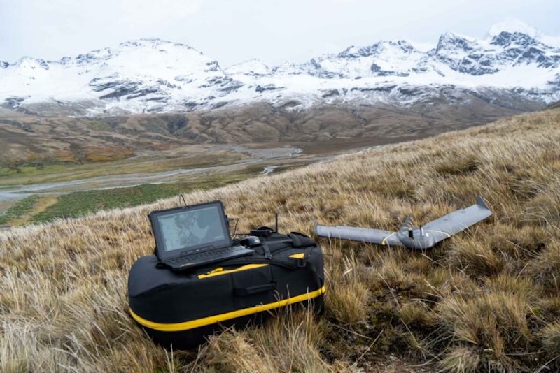
The lightweight eBee X drone can be carried into the field in a backpack before being launched by hand to carry out fully autonomous survey flights lasting up to 90 minutes.
At South Georgia, BAS researchers have been authorised to fly the drone beyond visual line of sight, allowing them to survey wildlife colonies spread across remote coastlines.
Nathan Fenney, who heads geomatics at BAS, says the approach dramatically increases the area scientists can study.
“Traditionally small drone operations have typically been conducted within what’s called ‘visual line of sight’ (VLOS), which requires the drone to stay within around 500 m of the pilot during the flight,” says Fenney.
“By being able to operate ‘beyond visual line of sight’ (BVLOS) with platforms like the eBee X, we are able to survey significantly larger areas, potentially over several kilometres, and survey targets not otherwise accessible overland, leaving us best placed to capture both South Georgia’s largest and more remote wildlife colonies.”
The resulting imagery has enabled scientists to develop new methods for counting wildlife using three-dimensional terrain models rather than individual photographs.
Those surveys confirmed that one of South Georgia’s largest king penguin colonies has grown to more than 132,000 breeding pairs while also revealing major declines in southern elephant seals following outbreaks of bird flu.
Bigger drones replace aircraft
Larger autonomous aircraft are beginning to change Antarctic geology as well.
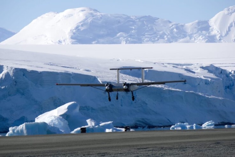
The Windracers ULTRA unmanned aircraft has a wingspan of 10 metres, can carry payloads of up to 60 kilograms and fly distances approaching 1,000 kilometres without a pilot onboard.
For BAS geologist Dr Tom Jordan, that means geological surveys that once required crewed aircraft can increasingly be performed autonomously.
The drone carries instruments including radar, magnetometers and gravimeters to investigate rock formations hidden beneath Antarctica’s ice sheet.
“For years the instruments were too heavy and the drones too small. Now the lines have crossed – the sensors are light enough and the drones are capable enough that using them for serious Antarctic science finally makes sense,” Jordan explains.
“By moving our surveys on to drones, we can do the same science with a fraction of the fuel and logistics. Instead of needing 200 drums of fuel for a big aircraft, we might get away with 20 for a Windracer.
“Using a drone for survey also frees up our Twin Otter aircraft for other critical work supporting field teams, or surveying with larger sensors, making the best use of all our assets.”
Robots support, rather than replace, scientists
Despite the rapid growth of autonomous systems, BAS researchers do not see robots replacing scientists.
Instead, they view them as filling the gap between satellites observing Earth from space and researchers working directly in the field.
Professor Petra Heil, BAS director of science, believes artificial intelligence will become increasingly important in coordinating these different sources of information.
“AI can show us where our science is blind. It can pull together satellites, models and past measurements to highlight the hotspots of uncertainty. You need AI to manage the data, to target where you send the platforms, and to keep reshaping the missions as the environment and the technology change.”
Even so, there remain some tasks that robots cannot perform.
As Ratcliffe points out: “There’s no drone I know of that can catch, weigh and put a tag on a penguin; or collect their poo to look at what they’ve been eating.”
Main image: Deployment of a Slocum Glider nearby Sheldon Glacier in Antarctica (Credit: Athena Dinar).
Source: British Antarctic Survey. Full article here.
