
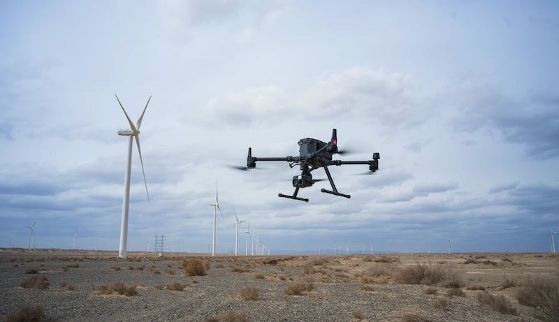
Imagine a future where drones only fly when invited and under boundaries drawn digitally across the sky. This is the new reality that airspace management is redefining thanks to geofencing, a technological marvel.
This article explores the many uses of geofencing as a component of a multi-layered counter drone solution, assisting organizations in preventing unwanted incursions and optimizing drone-powered services.
Are counter-drone solutions essential?
Drones could pose significant security issues, such as interfering with privacy rights or interrupting vital operations. This is the developing drone age reality, and to protect our skies and ground, we need effective counter-drone technologies.
Counter-drone solutions, in general, refer to any technology or tactic used to identify, track, and interfere with drone activity that is malevolent or unauthorized. This covers various instruments and techniques, such as drone capture nets, signal jamming, radar, and radio frequency detection systems.
Let’s consider a high-level case study to illustrate the need for counter-drone solutions:
A sizeable athletic event fills a packed stadium with thousands of people. Excitement and applause are heard when a rogue drone with a dangerous payload enters the airspace.
There’s a real chance of calamity if rogue drones are not dealt with.
Drilling down into Geofencing Constituents
Drones adhering to the constraints of invisible barriers.
That is basically what is meant to be understood as geofencing: defining allowed operating regions for drones employing radio frequencies, GPS, or a combination of both.
Invisible Boundaries
Using mapping tools and software, authorized entities designate no-fly zones around sensitive places, such as airports, government buildings, or essential infrastructure. Drones use these imperceptible walls as digital boundaries.
Drones Entering No-fly Zones
Geofencing software initiates preset reactions when a drone reaches a prohibited area. Depending on the severity of the incursion and the applicable rules, they can include anything from warnings and alerts to automated landing directions or even drone immobilization.
Drone Firmware Additions
Drone firmware and geofencing technologies seamlessly provide real-time communication and no-fly zone compliance. Think of it as a digital leash that confines drones to authorized areas.
Regulatory Compliance Impacts on Geofencing
When it comes to drone operations and regulatory compliance, geofencing is essential. Drone operators can ensure ethical airspace control and avoid legal ramifications by abiding by pre-defined no-fly zones.
Real-time Geofence Monitoring
State-of-the-art geofencing technology enables authorities to monitor drone activities within and near no-fly zones in real-time. This makes situational awareness possible and makes it possible to react quickly to unwanted invasions.
Pliability of Geofencing
Geofencing changes with time. No-fly zones can change dynamically in response to transient events or evolving security requirements. It is an effective instrument for flexible airspace control because of its adaptability.
Privacy Concerns During the Implementation of Geofencing
Although geofencing improves security, privacy issues are brought up by it. Drone monitoring data must be managed carefully, striking a balance between individual privacy rights and counter-drone operations.
Other Uses for Geofencing
The adaptability of drones and geofencing to different industries is broad.
Drones can be configured to drop off packages in predetermined zones, guaranteeing timely and precise delivery by limiting drone movement over particular crops or areas.
Geofencing aids in managing precision agricultural applications. Drones can also be used for search-and-rescue inside predetermined boundaries, which increases drone effectiveness and security.
A Key Component of Layered Security
While not a magic bullet, geofencing is essential to a well-rounded counter-drone solution. Combining detection and jamming technologies offers a multifaceted defense strategy for protecting vital infrastructure and airspace.
In the end, geofencing shows how technology can be used to protect public safety in the increasingly complicated realm of unmanned flight.
Conclusion
Drone software and geofencing can enforce no-fly zones and pre-programmed actions in real-time. Beyond counter-drone efforts, its adaptability offers location-based services to various sectors.
Geofencing, a vital part of multilayer counter-drone measures, exemplifies how technology can guarantee citizen security in the drone era. I hope this more thorough explanation clarifies the main ideas behind geofencing and its importance in today’s counter-drone technologies and beyond.
It is our responsibility to keep our skies safe. We can guarantee the safe and responsible use of drones that is advantageous to all parties by proactively obtaining expert advice and putting robust layered counter-drone systems into place.
