
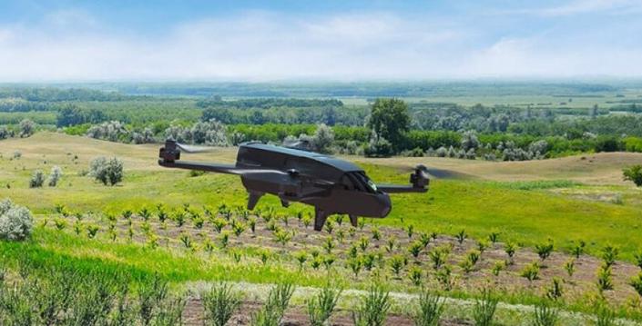
Parrot Business Solutions has launched Parrot Bluegrass Fields, an end-to-end drone solution for agriculture.
The newest member of Parrot’s drone portfolio, the solution combines the existing Parrot Bluegrass quadcopter drone, which integrates the Parrot Sequoia multispectral sensor, with the new ParrotFields mobile mapping app and Pix4Dfield desktop and cloud-based drone-mapping software.
The result is a comprehensive, ready-to-fly drone solution that spans the entire crop analysis workflow, for farmers to monitor crops and identify problem areas in their fields.
It offers up to 25-minute flight time (three batteries are included), flight coverage of up to 65 ha (160 ac) at 122m (400 ft) and a backpack for transportation.
Parrot Bluegrass Fields suits both precise crop mapping and visual scouting. It includes the Parrot Sequoia multispectral sensor (4 multispectral mono-bands, 1.2 MP, global shutter) and a 14 MP front RGB camera to capture both pictures and videos in Full HD (1080p).
It includes includes a one-year subscription to the ParrotFields mobile mapping app and a one-year subscription to Pix4DFields desktop and cloud software for further analysis of crop data, including the creation of index maps for crop performance analysis and prescription maps that are easily exported to tractors and Farm Management Information Systems.
