Niantic Spatial has launched two new products aimed at enabling artificial intelligence systems to operate more effectively in physical environments, as companies continue to explore so-called “world models” – AI systems designed to understand and interact with real-world spaces.
The company says its new offerings – Scaniverse for businesses and an updated Visual Positioning System (VPS 2.0) – are intended to address what it describes as a key limitation in current AI development: the lack of accurate, machine-readable maps of the physical world.
While AI systems have advanced rapidly in digital domains, Niantic Spatial argues that much of the global economy – including sectors such as construction, energy, logistics, and manufacturing – remains difficult for AI to access due to the absence of detailed spatial data.
Capturing real-world environments
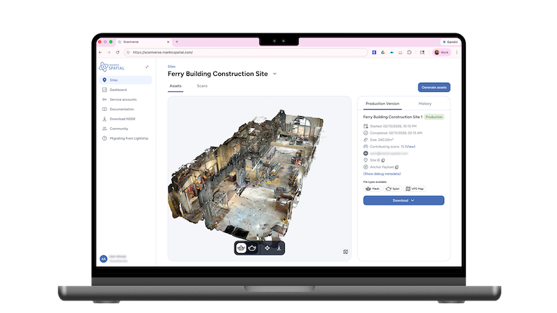
Scaniverse for businesses is a platform designed to allow companies to capture and reconstruct physical environments using smartphones or 360-degree cameras. According to Niantic Spatial, the system can generate 3D representations of real-world locations, including meshes and so-called Gaussian splats, which can be used to train and deploy robotics and AI systems.
The platform supports collaborative data capture, enabling multiple users to contribute scans that are combined into a single model stored in the cloud. The company says the system can handle environments ranging from individual rooms to large industrial sites.
Niantic Spatial claims that Scaniverse can operate using standard consumer devices, removing the need for specialized scanning hardware.
Improving positioning where GPS falls short
Alongside Scaniverse, the company introduced VPS 2.0, an updated version of its visual positioning technology.
The system uses camera input and computer vision to determine position and orientation, offering what Niantic Spatial describes as “near centimeter-level” accuracy in mapped environments. The company says the technology is designed to function in areas where GPS is unreliable, such as indoors, underground, or in dense urban environments.
Unlike earlier versions, VPS 2.0 does not require prior scanning to function at a basic level. It can provide broader positioning support globally and then transition to higher-precision localization in areas that have been mapped using Scaniverse.
Supporting robotics and spatial applications
Niantic Spatial says the new tools are part of a broader effort to build what it calls a “Large Geospatial Model” – a system intended to provide a shared spatial understanding for machines.
The company notes that its technology is already being deployed by delivery robotics company Coco Robotics, which is using VPS to support navigation in its autonomous fleet.
In addition to the two product launches, Niantic Spatial said it plans to release version 4.0 of its development kit later this month, with support for platforms including Unity, Swift, Android, and ROS 2, a framework commonly used in robotics.
Focus on the physical economy
The company positions the launch within a wider shift in AI development, arguing that progress in physical-world applications depends less on advances in intelligence and more on access to reliable spatial data.
Niantic Spatial says its tools are designed for use across industries including robotics, construction, energy, logistics, and the public sector, where accurate positioning and mapping remain ongoing challenges.
