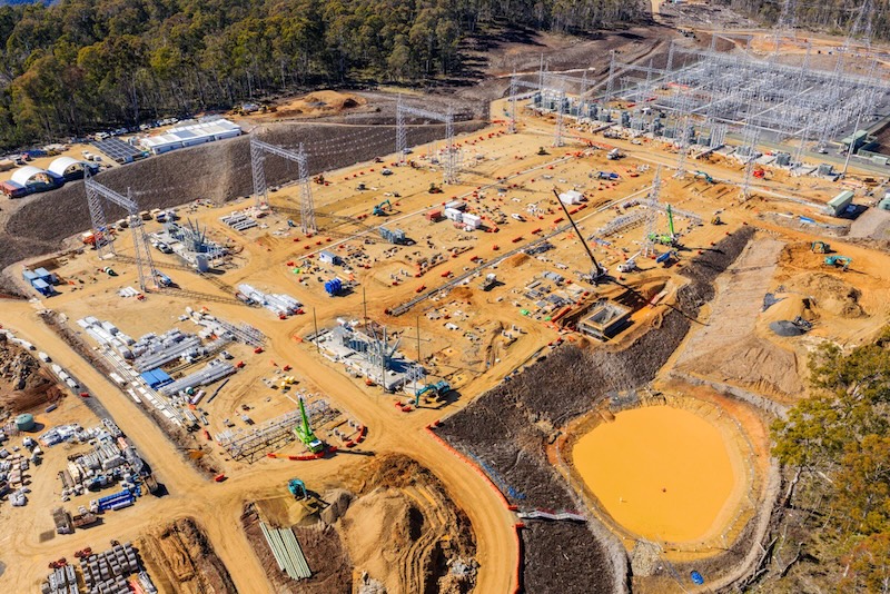
Skyports Drone Services, a provider of drone delivery and inspection services, is providing fully automated Beyond Visual Line of Sight (BVLOS) “drone-in-a-box” surveying for the HumeLink West power lines project in New South Wales, Australia.
HumeLink West forms part of Transgrid’s HumeLink project, which will deliver approximately 140 km of new 500 kV double-circuit transmission lines and two substations, strengthening Australia’s electricity network and supporting the country’s transition to renewable energy.
A permanently deployed DJI Dock 2 at the Maragle substation construction site flies automated surveys every two weeks, remotely piloted from Skyports’ Remote Operations Centre in Lane Cove, Sydney – more than 350 km away.
This aerial captured data is then providing HumeLink West’s construction teams with consistent, repeatable and high-resolution aerial data, enabling safer inspections, more frequent progress monitoring and faster decision-making.
Scaling infrastructure site surveys with BVLOS
Compared with traditional on site drone surveys, the remotely operated drone can survey up to five times more area in a single day. Enabled by advanced BVLOS approvals, the drone can routinely fly missions of up to approximately 8-10 km – significantly extending the roughly 0.5-1 km operational range under conventional visual line of sight operations.
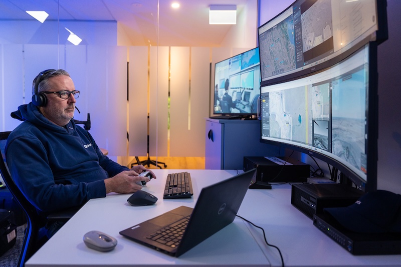
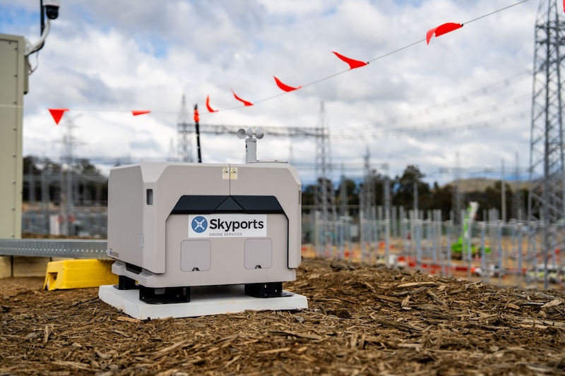
Flying remotely also removes the need for personnel to access difficult terrain or active construction zones, improving safety while providing project teams with more frequent, higher-quality data.
The BVLOS programme builds on a 12-month Extended Visual Line of Sight (EVLOS) surveying campaign delivered by Skyports, during which the team used LiDAR-equipped drones to map terrain and monitor vegetation clearing along the transmission corridor.
Unlocking BVLOS operations in Australia
The deployment has been made possible through Skyports’ Broad Area BVLOS Drone Approval, issued by the Civil Aviation Safety Authority (CASA).
This allows Skyports to self-authorise BVLOS operations across eligible remote and sparsely populated areas, significantly reducing deployment times for customers while expanding the scale and efficiency of commercial drone operations.
Skyports is one of only a small number of operators in Australia to hold this approval and is among the first to deploy it on a major infrastructure construction project.
More remote “drone-in-a-box” deployments are set to be added across additional key operational sites in Australia in Q3 2026, with Skyports total global deployment set to reach 25 boxes by the end of the year, and more than double in 2027.
The programme also marks the first time a CIMIC Group project in Australia has been authorised to undertake fully remote BVLOS drone operations.
Turning aerial data into actionable insights
Survey data captured during each flight is then processed through DroneDeploy, a reality capture platform, that produces detailed 2D and 3D site models while tracking changes over time.
These digital outputs provide HumeLink West’s construction teams with an accurate, continually updated view of the project progress, enabling earlier identification of issues, more informed decision-making and improved project delivery.
Alex Brown, CEO, Skyports Drone Services, says: “HumeLink West demonstrates how advanced drone operations are transforming the way major Australian infrastructure projects are delivered.
“As one of only a small number of operators in Australia authorised to conduct these types of BVLOS drone operations, we’re providing customers with a more intelligent, safer and cost effective way of monitoring the construction of some of the country’s most important infrastructure projects.”
Tim Burns, project director, HumeLink West, says: “On a project of this scale, you need reliable, up-to-date information that helps you make decisions with confidence.
Skyports’ remote drone surveys are giving our construction teams a clear, consistent picture of what’s happening across the site, allowing us to track progress more effectively, respond to issues sooner and keep work moving.
“Just as importantly, being able to capture that data remotely means fewer people are working in active construction areas, helping improve safety.”
